Basemap Gallery Widget
The Basemap Gallery Widget allows you to switch between different Basemaps.
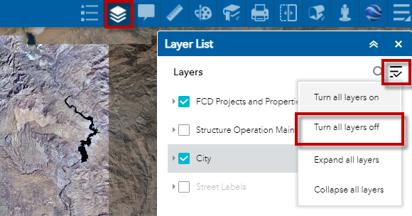
First, open the Layer List Widget and turn all Layers off.
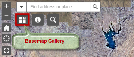
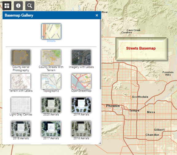
Next, open the Basemap Gallery Widget.
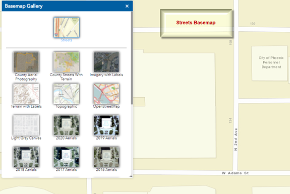
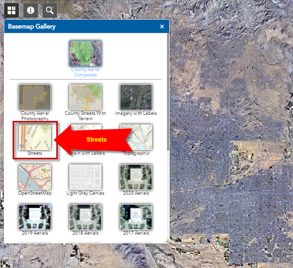
Select the Streets Basemap
You are now viewing the Streets Basemap
You can overlay any two basemaps and adjust their transparency.
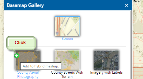
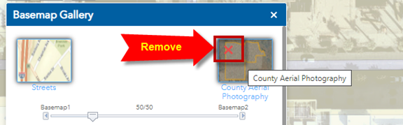
Hover your mouse over the County Aerial Photography Basemap.
A green plus sign will appear.
Click on this green plus sign.
You can adjust the transparency slider.
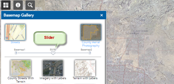
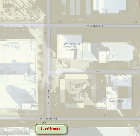
This gives you a mashup of the Streets Basemap and the County Aerial Basemap.
Zoom in closer. Adjust the slider where you can clearly see the Street Names.
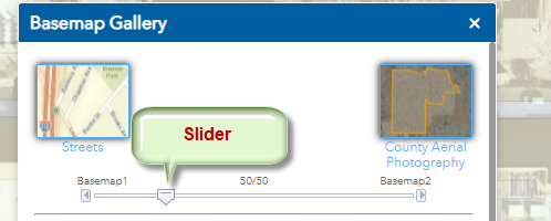
To remove the County Aerial Basemap click on the red X icon.
You are now viewing just the Streets Basemap.