Measure an Area
You are going to measure the area of the selected Parcel.
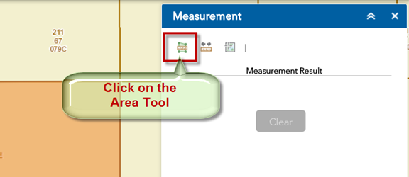
Click to activate the Area Tool.
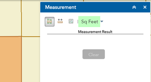
The default unit of area measurement is Square Feet.
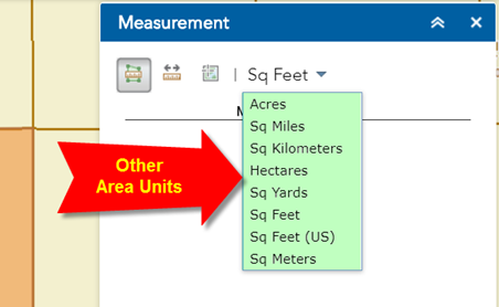
Click on the down arrow to view the list of other units available to you.
Keep the default area unit = Sq Feet
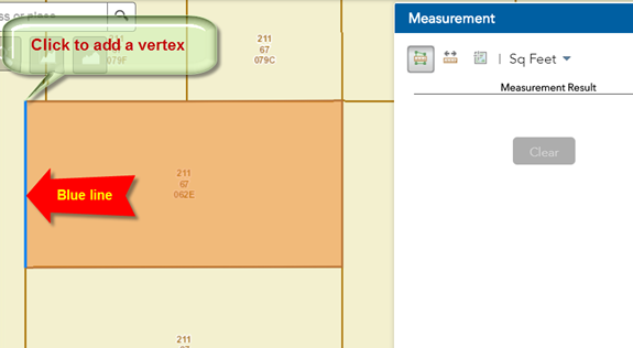
Move your mouse and click once on the lower left corner of your Parcel.
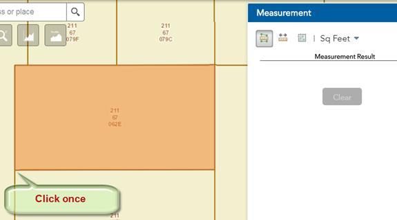
You have established the starting vertex of your Polygon.
Notice the blue line as you move your mouse.
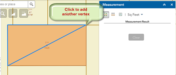
Move your mouse to the upper left corner of your Parcel.
Click once to add a vertex.
Move your mouse to the upper right corner of your Parcel.
Click once to add another vertex.
The area of the shaded triangle defined by the three vertices is 23,648.9 sqft.
Note: You need a minimum of three vertices to define an area.
The Measurement Result shows 23,648.9 Sq Feet
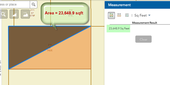
However, you are not interested in this triangle.
You want to find the area of the complete Parcel.
Move your cursor to the lower right corner of the Parcel.
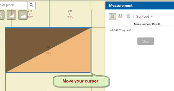
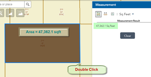
Double Click your mouse.
This completes the Polygon.
The Area of this shaded polygon = 47,362.1 sqft
Press Clear to remove the shaded polygon.
Remember, to draw a polygon:
Start with a single click to define your starting vertex.
Click to add more vertices as you trace your polygon.
Double Click to close your polygon.
Open the Enhanced Search Widget.
Notice, the Lot Size of this selected Parcel = 46,814 sqft
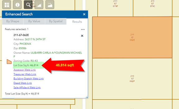
The polygon that you traced over Parcel 211-67-062E shows a slightly larger area of 47,362.1 sqft
What happened?
How do you explain this difference?
Run the Area Measurment Tool once again, but this time trace the blue line hugging the inside of the Parcel boundary like so:
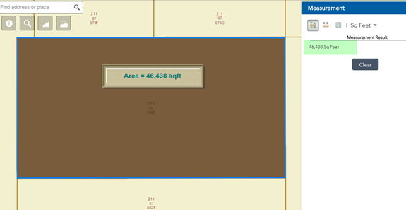
The area returned by the shaded polygon = 46,438 sqft
Now this is slightly less than the Parcel Lot Size = 46,814 sqft
Which value should you trust?
Always trust the value of the Lot Size attribute in the Parcel database.
This is the legal value.
If you attempt to find the area by tracing a polygon over the parcel boundary, you may get a close approximation but seldom the actual value.