To properly display this page you need a browser with JavaScript support.
Historical Aerial Photography Web Application
User Guide
×
Menu
Index
Search
Search
Search
Navigation Tools
Find My Location Tool
Previous page
Next page
Print version
© 2023 Maricopa County
To properly display this page you need a browser with JavaScript support.
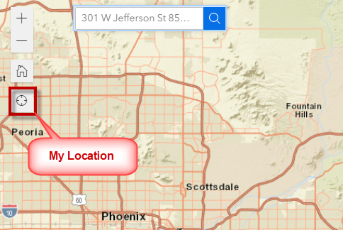
Find My Location Tool
This works on a Tablet with Location Services turned on.
Click on the
Find My Location Tool
.
The map will zoom to your current location.