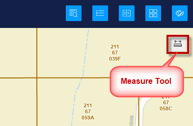
Measure Tool
Open the Measure Tool on the top right of the map.
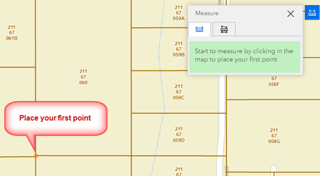
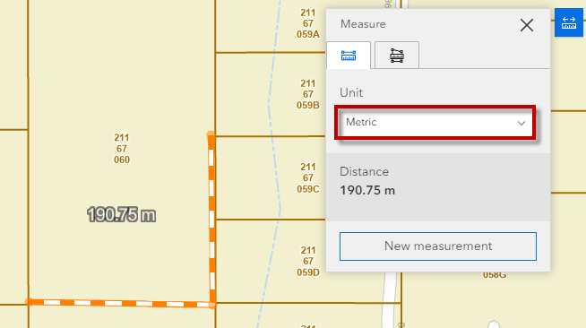
By default, the Measure Tool is ready to measure any length.
Place your first point on the map by clicking with your mouse.
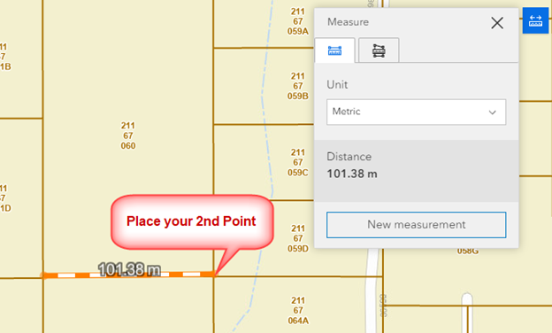
Move your mouse and click to place the 2nd point.
Move your mouse again and double click to end the line.
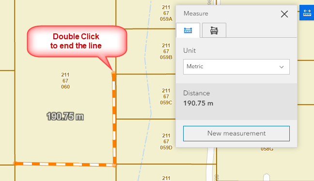
The length of this line is 190.75 meters.
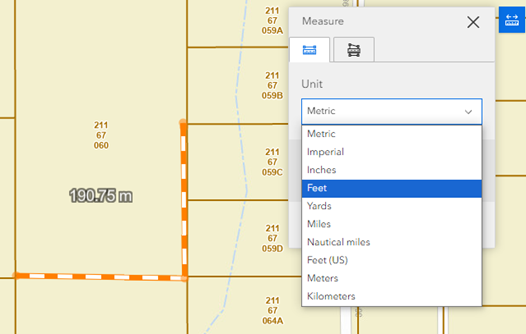
You can change the measurement units.
Open the Unit drop-down.
Select Feet
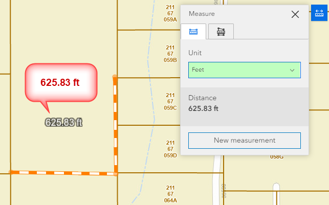
The length of your line is 625.83 ft.
Note:
Feet represents International Feet based on 1 inch = 2.54 cm exact.
Feet (US) represents US Survey Foot = 1200/3937 meters.
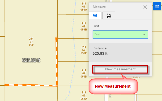
Click on New measurement to start a new measurement.
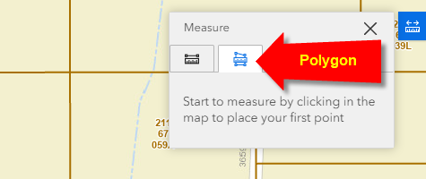
Open the Polygon Tool
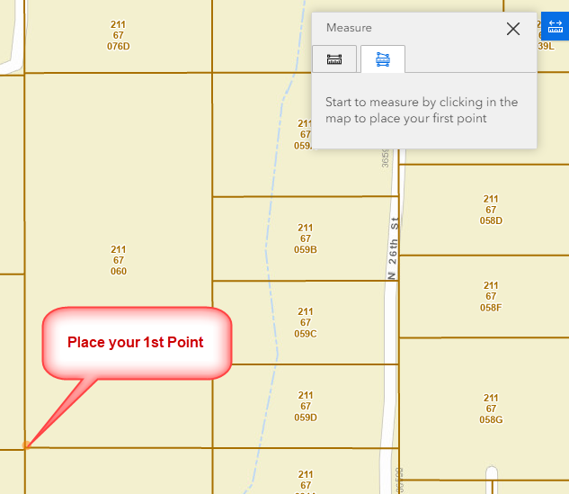
Place your first point on the map.
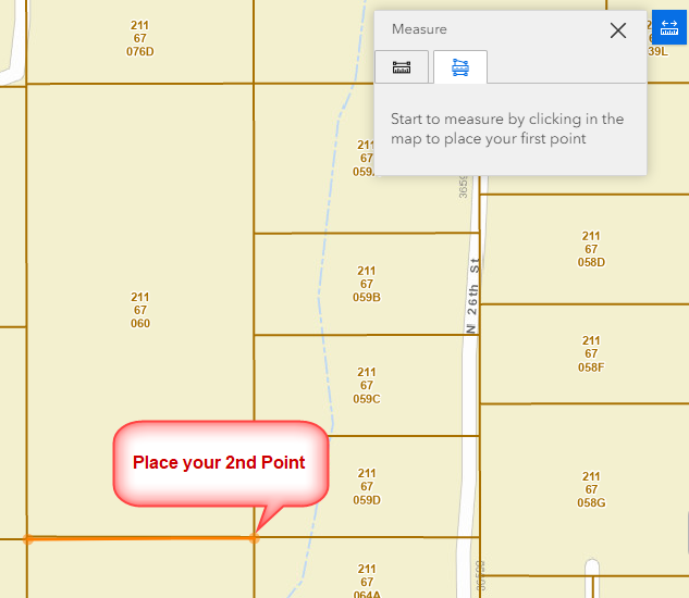
Place your 2nd point on the map.
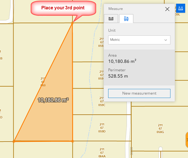
Place your 3rd point on the map.
Double Click on the 4th point to close the polygon.
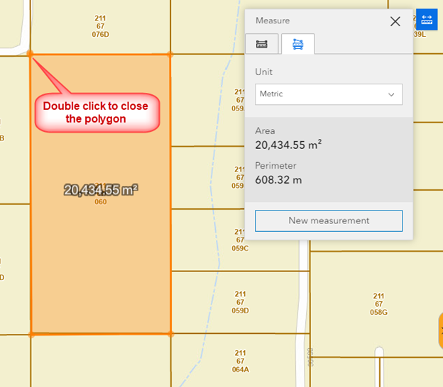
The area and perimeter are reported in square meters and meters by default.
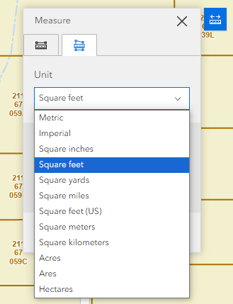
Change the units to Square Feet.
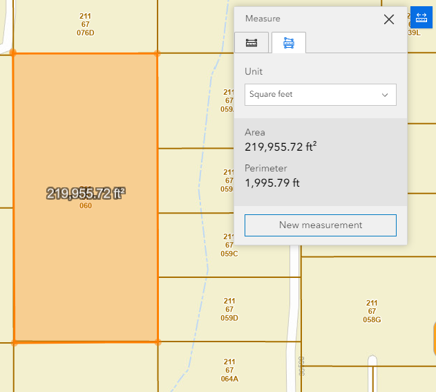
The area of your polygon is 219,955 sq ft.
The perimeter is 1995 ft.
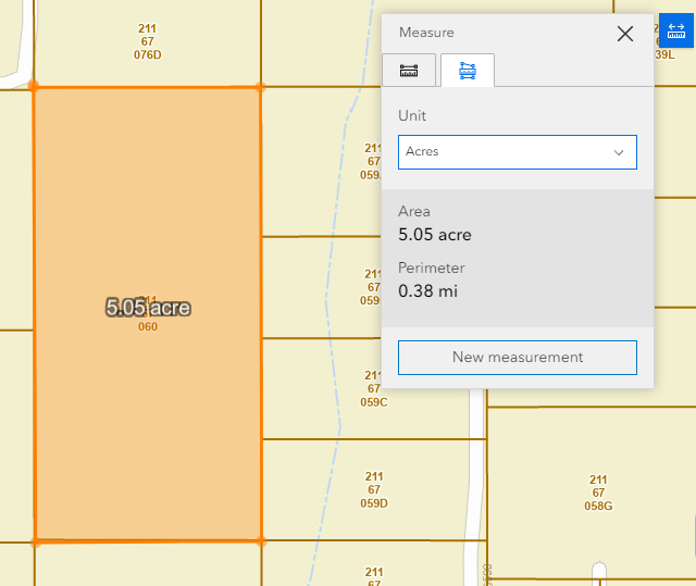
Change the units to Acres.
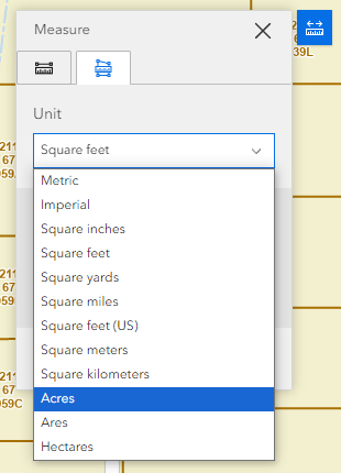
The area of your polygon is 5.05 acres.
The perimeter is 0.38 miles.
The Measurement Tool provides a handy way to measure lines and polygons and report the measurement in units of your choice.