To properly display this page you need a browser with JavaScript support.
Historical Aerial Photography Web Application
User Guide
×
Menu
Index
Search
Search
Search
Query Widget
Previous page
Next page
Print version
© 2023 Maricopa County
To properly display this page you need a browser with JavaScript support.
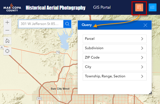
Query Widget
Open the
Query Widget
.
You can zoom to any Parcel, Subdivision, ZIP Code, City or Township and run Spatial Queries.
The contents of Query Widget
Using the Parcel Query
Using the Subdivision Query
Using the ZIP Code Query
Using the City Query
Using the Township, Range, Section Query