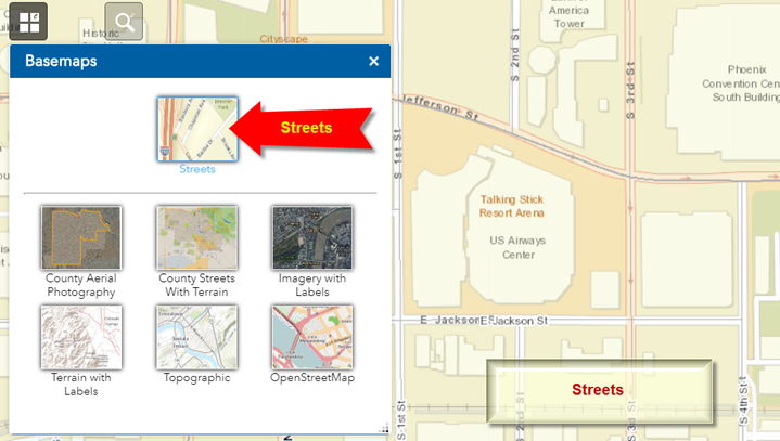
Basemaps Widget
Open the Basemaps Widget.
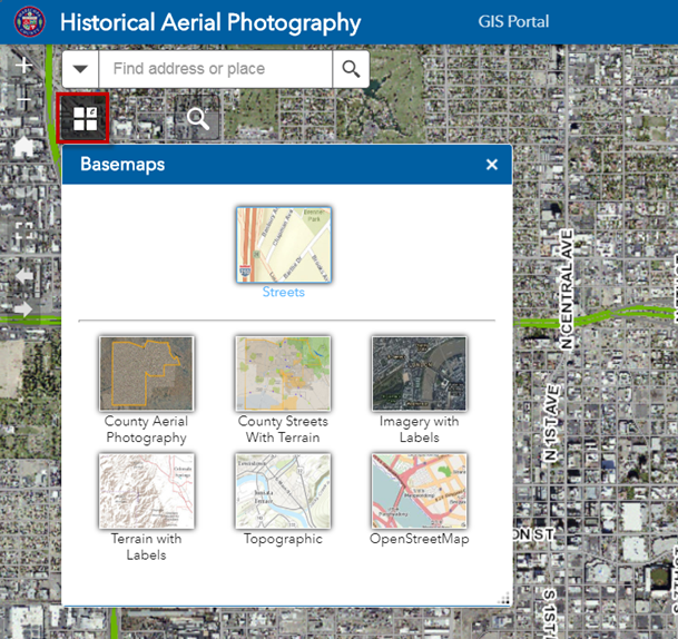
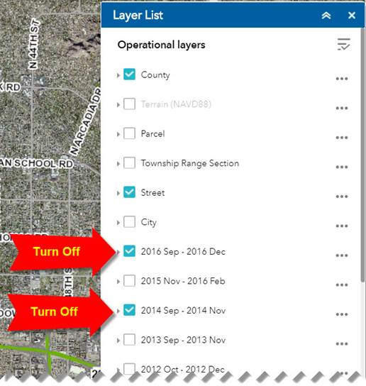
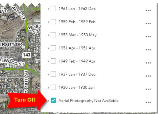
To use the Basemaps Widget you must first turn off all the Imagery Layers under the Layer List Widget.
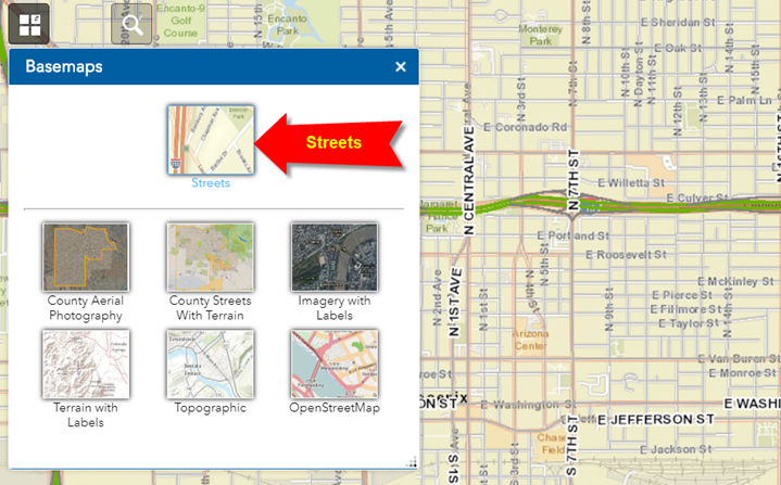
You are now viewing the Streets Basemap.
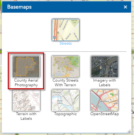
Click on the County Aerial Photography.
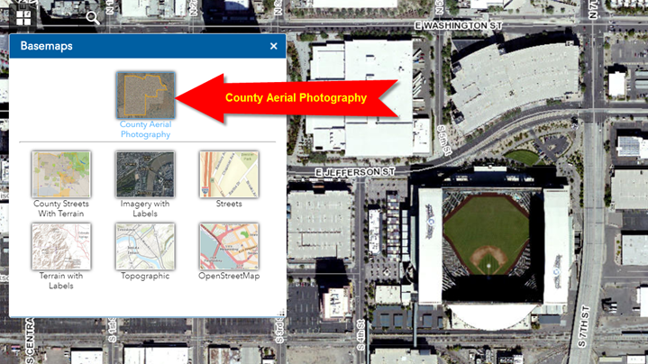
You are now viewing the County Aerial Photography.
This is a mosaic made up of the best available imagery.
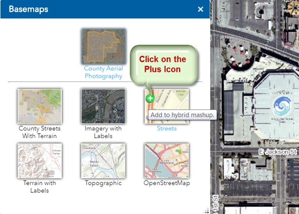
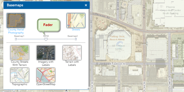
You can combine any two basemaps to make a mashup.
Click on the Plus Icon on the Streets Basemap
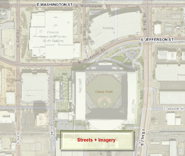
You can adjust the slider to fade between the Aerial Basemap and the Streets Basemap.
Click on the Red X Icon to remove the Aerial Basemap from the mashup.
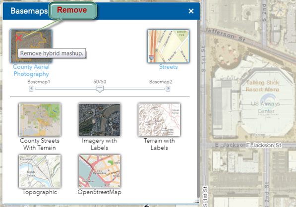
Now you are viewing the Streets Basemap alone.