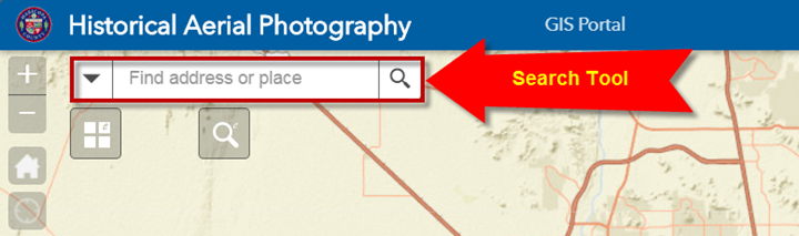
Search Tool
The Search Tool is the fastest way to find an Address or Place.
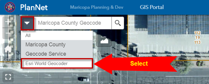
Click on the down arrow and select the Maricopa County Geocode Service

Enter an Address:
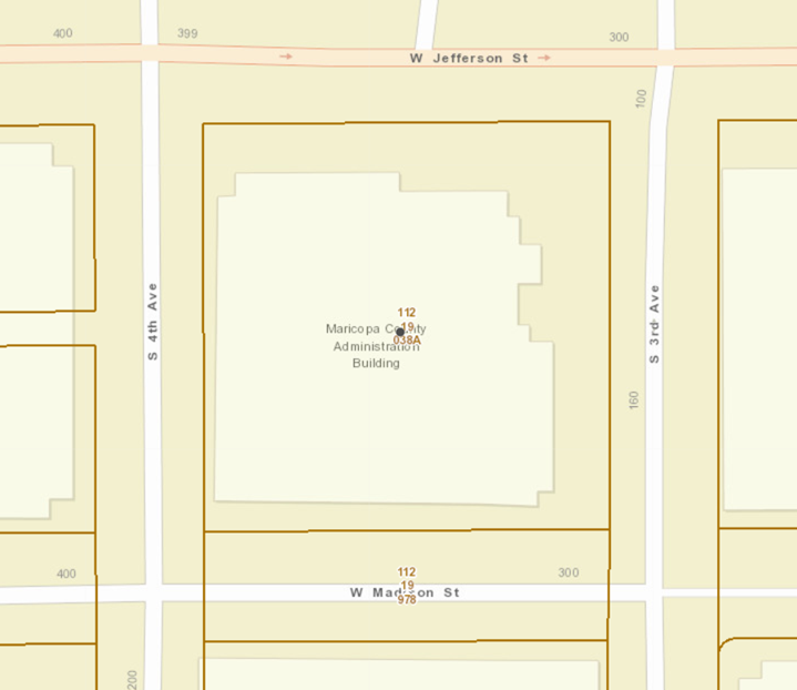
301 W JEFFERSON ST

Click on the Search Icon.
A drop down list with possible matches will appear.
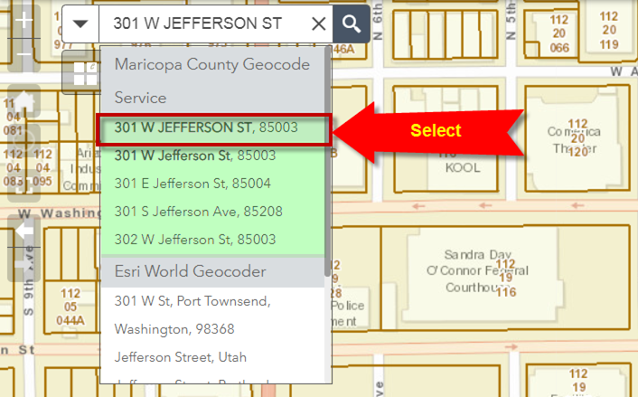
Select 301 W JEFFERSON ST, 85003
The map zooms to this address:

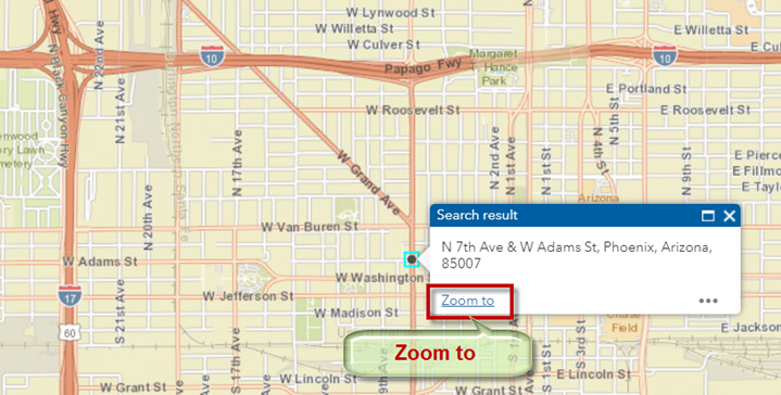
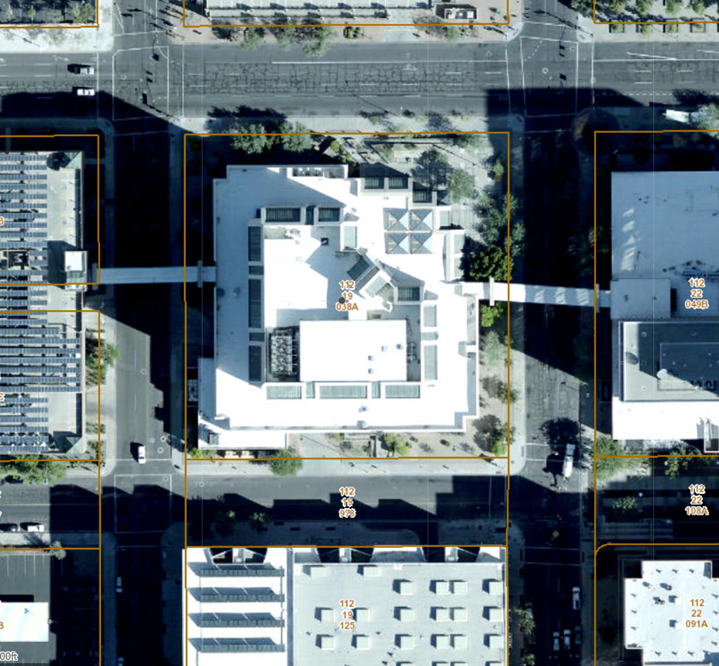
Click on the Zoom to button.

The map zooms to the Maricopa County Administration Building.
Open the Basemaps Widget and switch to the County Aerial Photography Basemap.
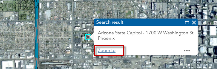
You may also search for a Place Name.
Example: Arizona State Capitol
To use this feature you must switch to the Esri World Geocoder.
As you begin typing Arizona State Capitol, you will get a list of possible matches.
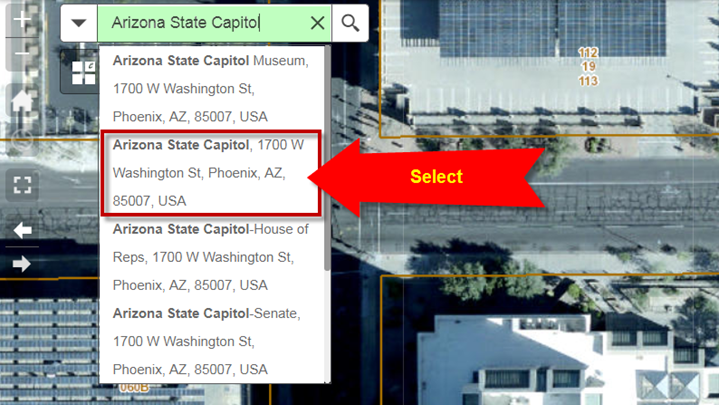
Select Arizona State Capitol, 1700 W Washington St, Phoenix, AZ, 85007, USA
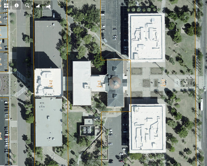
Click on the Zoom To button.
Switch to the 2018 Aerials
Switch to the Streets Basemap.
You may also enter a Street Intersection while using the Esri World Geocoder.

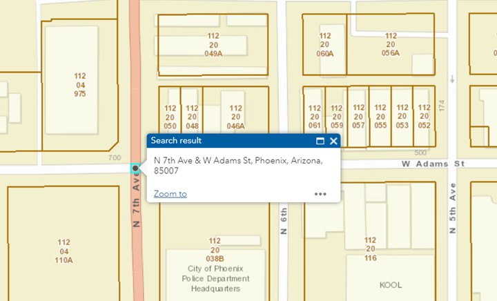
Enter: N 7TH AVE & W ADAMS ST

Select N 7th Ave & W Adams St, Phoenix, AZ, 85007, USA