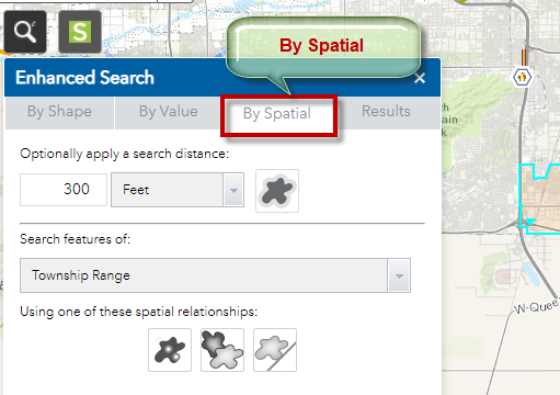
Search by Spatial Analysis
You need to first select a feature before you can run any Spatial Analysis on it.
You are going to find all the Townships that are intersected by the City of Chandler.
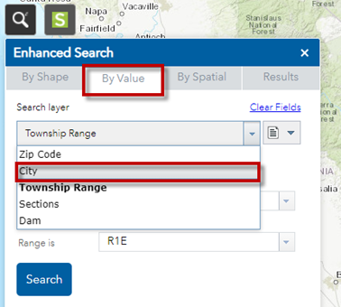
Open the By Value Tab.
Set Search Layer = City
Select City of Chandler
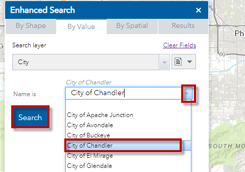
Press Search
The map zooms to the City of Chandler
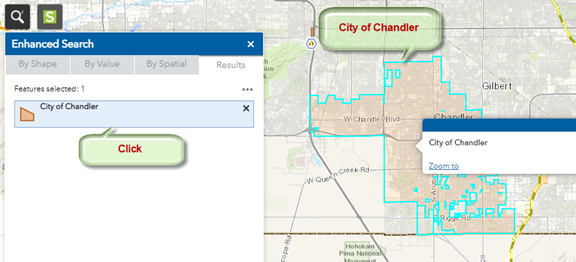
The outline of the City of Chandler is highlighted in Cyan.
Open the By Spatial Tab
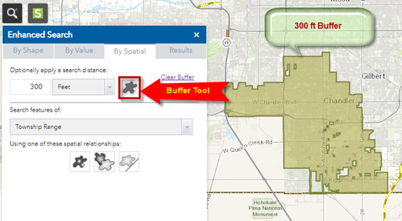
Click on the Buffer Tool.
This draws a 300ft buffer around City of Chandler.
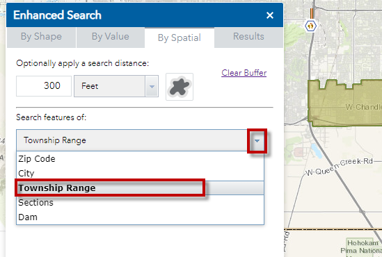
Click on the down arrow.
Select Township Range
Select the Intersected By Tool
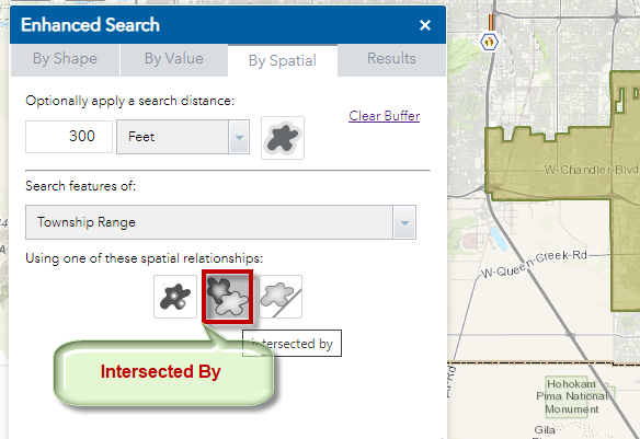
Select the Buffer option
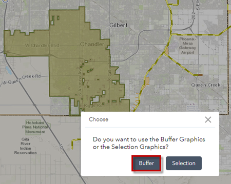
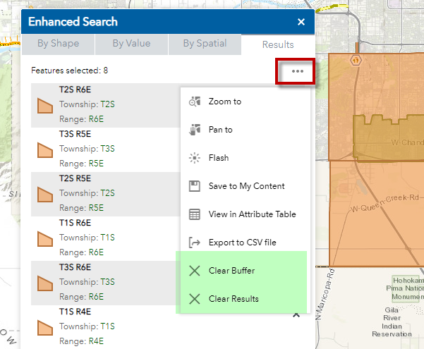
There are 8 Townships that are intersected by the City of Chandler.
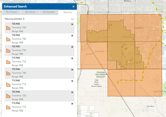
Open the Results Menu.
Clear the Buffer
Clear the Results