Searching by Drawing a Shape
You may also search for a feature by drawing a Shape on the Map.
Refresh the Map.
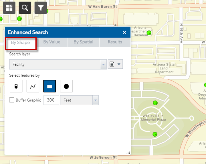
Open the By Shape Tab
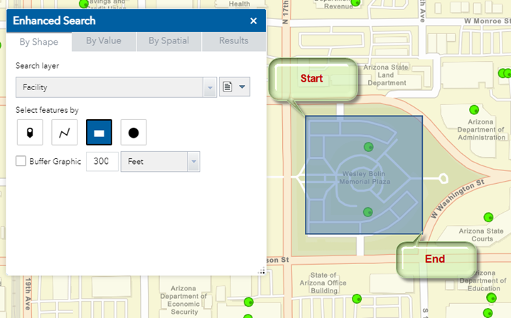
Press and hold down your left mouse button to drag a rectangle to lasso the two Facilities in the Wesley Bolin Memorial Plaza.
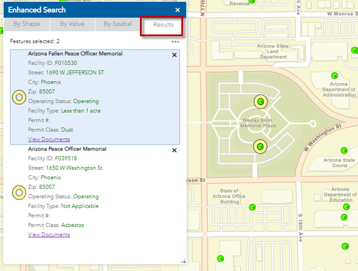
The Results Tab shows the attributes of these two Facilities.
Open the By Shape Tab.
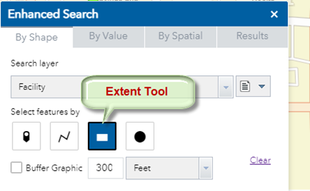
Notice, that the default drawing tool is Extent.
Besides drawing a rectangle, you may also draw a point or a line segment or a circle to select features.
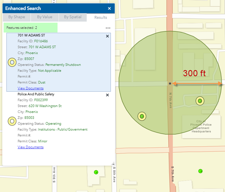
Let’s say you want to find all the Facilities within 300ft of the Street Intersection of N 7th Ave & W Adams St.
To perform this task, you would first need to zoom to this Street Intersection.
Next, you would need to define a circle of radius 300ft around this Intersection and find all the Facilities that fall within.
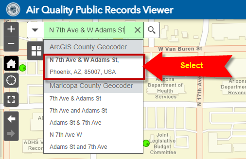
Enter this Street Intersection in the Search Widget:
N 7th Ave & W Adams St
Select N 7th Ave & W Adams St, Phoenix, AZ, 85007
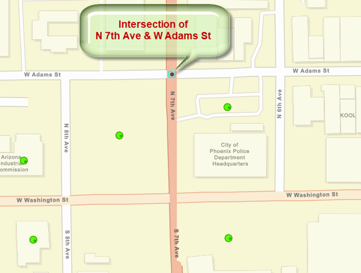
The map zooms to this Street Intersection.
There are many Facilities in the vicinity.
You want to find only those that are within 300ft of this intersection.
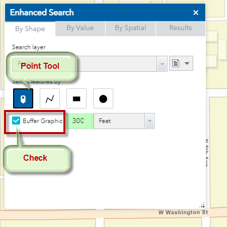
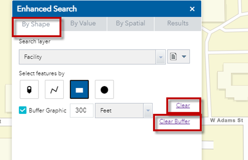
Open the By Shape Tab.
Select the Point Tool.
Check the Buffer Graphic option.
Set the Buffer Distance = 300ft
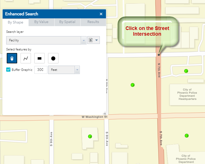
Click on the Street Intersection.
There are 2 Facilities within 300 feet of this Street Intersection.
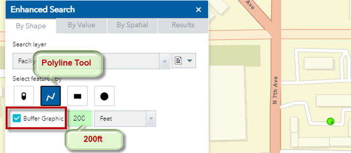
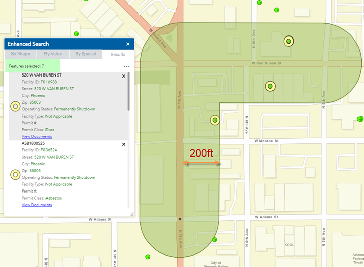
Next, you will locate all Facilities within 200 feet of a street segment.
Open the By Shape Tab.
Clear
Clear Buffer
Select the Polyline Tool.
Check the Buffer Graphic option
Set the Buffer Distance = 200ft
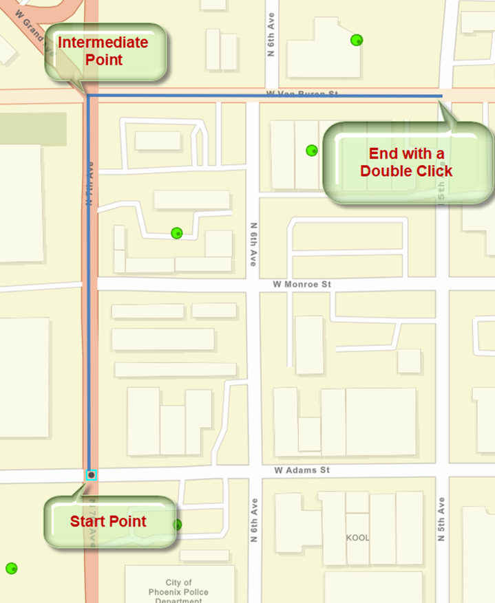
Draw a Polyline.
Start your Polyline with a mouse click.
Add Intermediate Points by Left Clicking your mouse.
End the Line Segment with a Double Click.
A green buffer is generated around your polyline.
7 Facilities are found within this buffer zone.
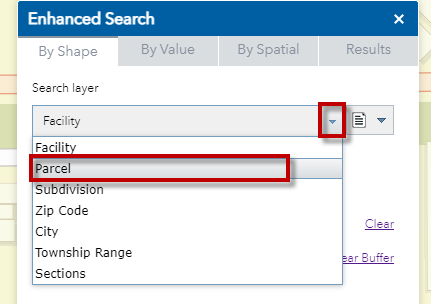
Open the By Shape Tab
Expand the Search Layer drop-down.
These are the list of Layers you can search on.
Select the Parcel Layer.
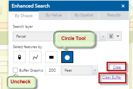
Clear
Clear Buffer
Uncheck the Buffer Graphic option
Select the Circle Tool
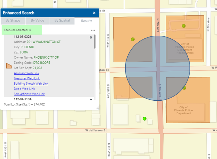
Click on any point on the map and drag a Circle
5 Parcels are found that intersect the blue circle on the map.