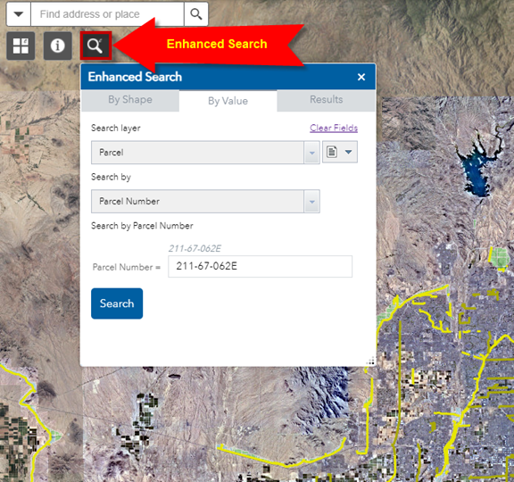
The Enhanced Search Widget is open by default when you launch the Web App.
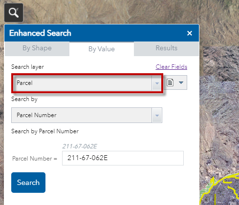
The default search layer is Parcel.
Press the Search button.
The map zooms to Parcel Number 211-67-062E
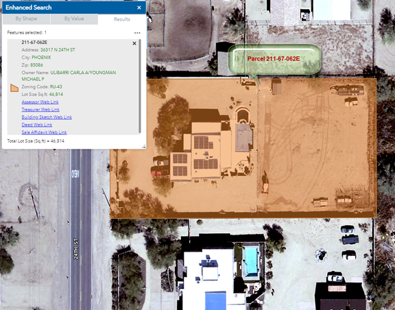
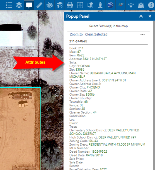
Click on the Result.
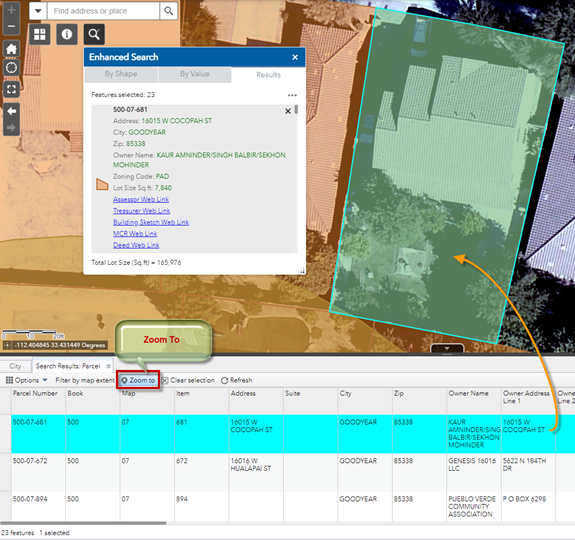
A Popup windows appears showing the Attributes of this Parcel.
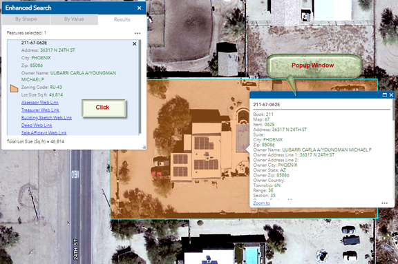
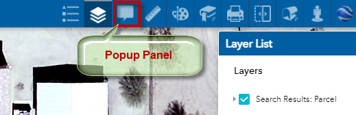
Open the Popup Panel Widget
The Attributes are now shown within the Popup Panel.
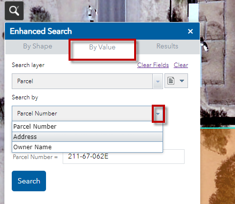
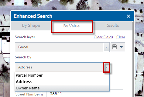
Open the By Value Tab
Besides the Parcel Number, you can select a Parcel by the Address or Owner Name.
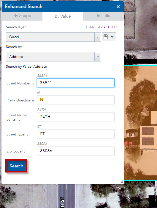
Click on the down arrow and select Address.
Accept the default address and Press Search.
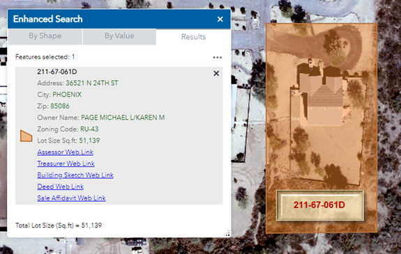
The Map Zooms to Parcel 211-67-061D
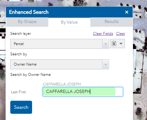
Open the By Value Tab.
Search by Owner Name
Accept the default owner name and press Search.
Note: The format for entering the Owner Name is:
Last Name First Name
The case does not matter.
Do not enter any commas.
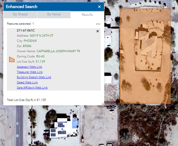
The Map Zooms to Parcel 211-67-061C
Open the By Value Tab
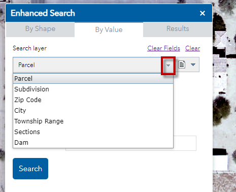
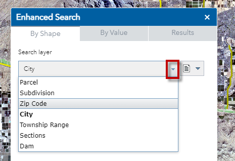
Besides searching for Parcels, you can also search for other layers.
Click on the down arrow next to expand the list of Search Layers.
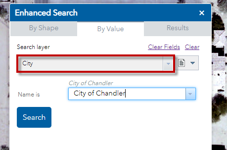
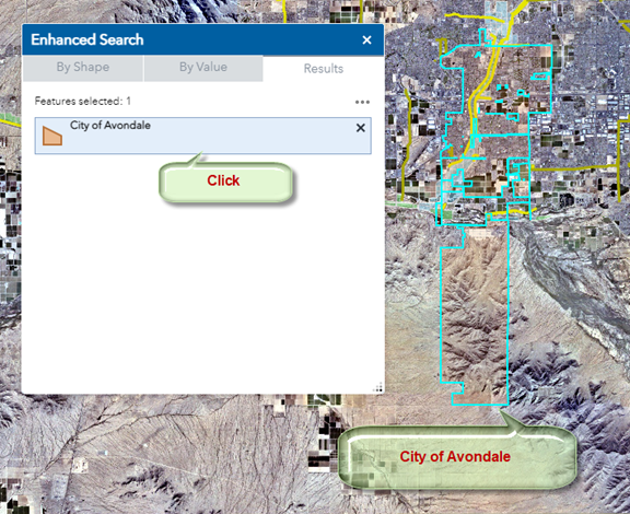
Select Search Layer = City
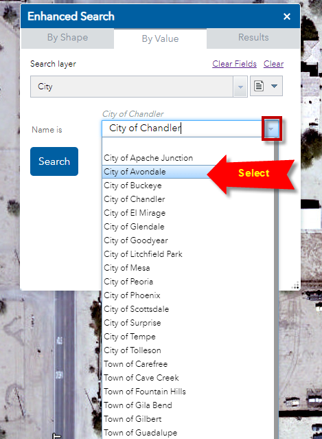
Select City of Avondale from the drop down list.
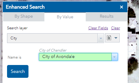
Press Search
Click on the Result. The City of Avondale is drawn with a blue outline.
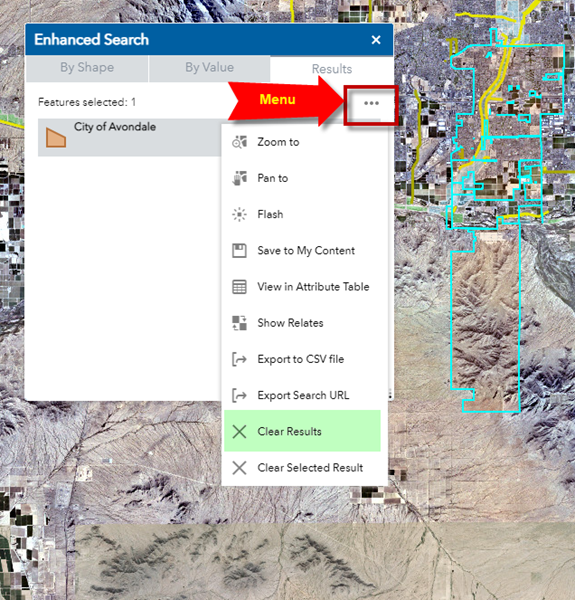
Open the Menu to see additional options.
Clear Results
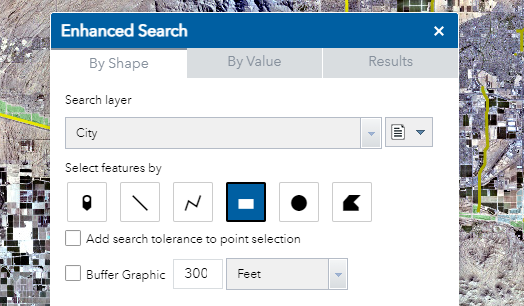
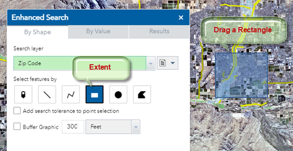
Open the By Shape Tab
Click on the down arrow and set Search Layer = Zip Code
The default Search Tool = Extent
Drag a rectangle on the map
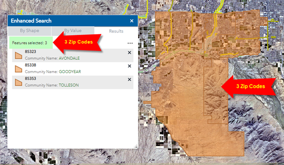
This rectangle intersects 3 Zip Codes
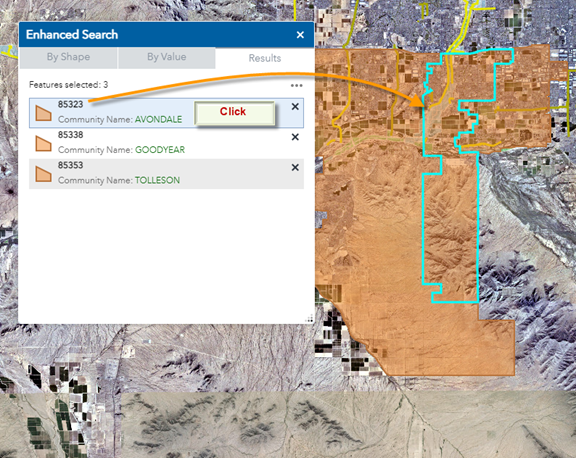
Click on the first result.
The map zooms to the selected Zip Code.
The selected Zip Code is shown with a cyan outline.
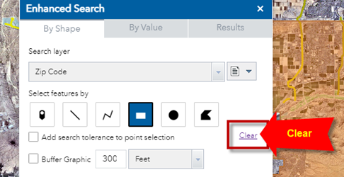
Clear the results
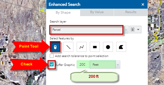
Next, you are going to find all the Parcels that fall within 200 ft of a given point.
Set the Search Layer = Parcel
Select the Point Tool.
Check the Buffer Graphic option and set the Buffer Distance = 200 ft
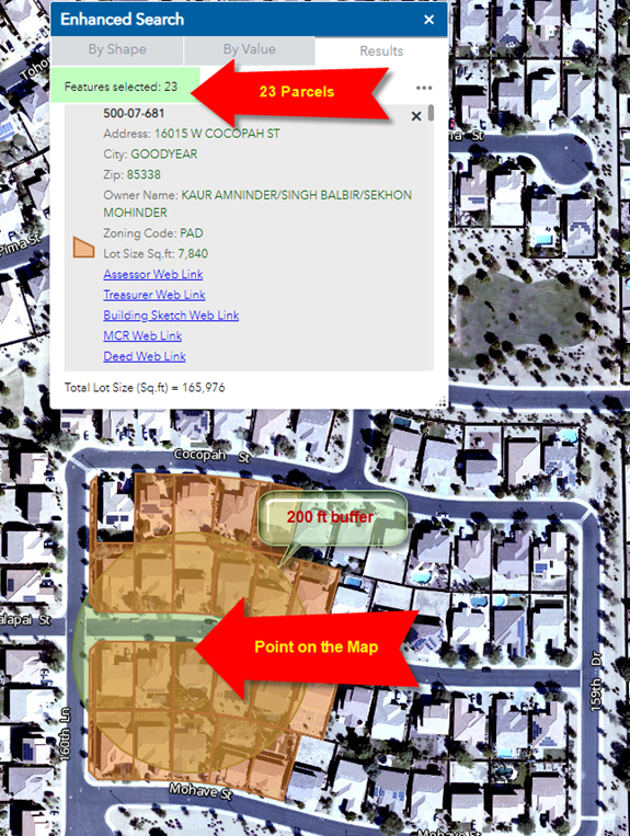
Click on any point on the map.
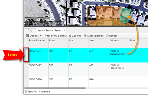
There are 23 Parcels intersected by the 200 ft Buffer around this point.
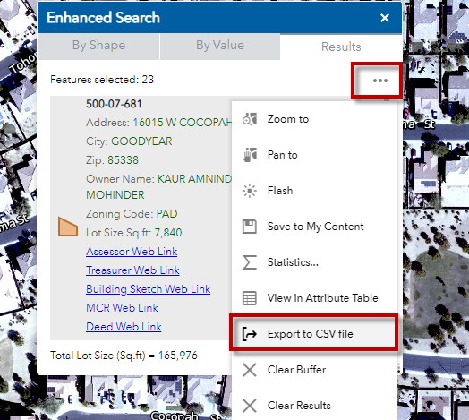
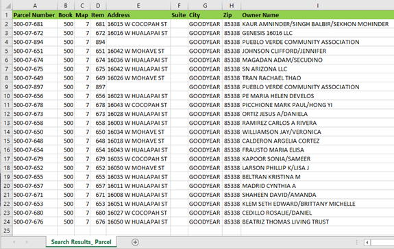
Expand the Menu and Export the Results to a CSV file.
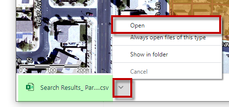
Open Search Results_Parcel.csv
This is how your Excel Table will appear showing all the Attributes.
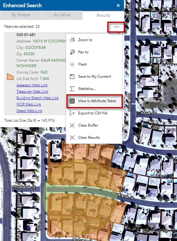
Open the Results Menu and select View in Attribute Table.
The Attribute Table opens
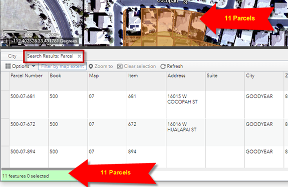
Notice, it is only showing 11 Parcels, not 23.
Why is that?
This is because you have Filter by Map Extent turned on.
The Attribute Table is showing only the Parcels that are withing the map extent.
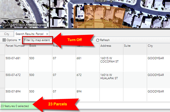
Turn off Filter by Map Extent
Now you can see the Attributes of all the 23 Parcels.
Click to Select a Parcel from the Attribute Table.
Press the Zoom To button to zoom to this parcel.