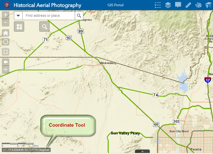
The Coordinate Tool tracks your Mouse Cursor in Decimal Degrees.
Move your mouse across the map.
The Coordinate readout will update continuously.
The display shows the Longitude (X) followed by the Latitude (Y) in Decimal Degrees with 6 decimal places.
The Longitude value is negative signifying West Longitude.
The Latitude value is positive signifying North Latitude.
The geographic coordinates are based on the International WGS 1984 Datum.
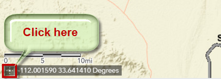
You can also spot check the coordinates of any point on the map.
Click on this icon.
Notice, how the icon turns blue.
The readout disappears. It is waiting for you to click on any point.
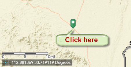
Click on any point on the map.
The display shows the Coordinates of this point.
Longitude (X) = -112.881869
Latitude (Y) = 33.719119
The display remains static as you move the mouse.
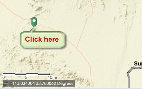
Move your mouse and click on another point on the map.
The display updates to show the Coordinates of this new point.
Longitude (X) = -113.034304
Latitude (Y) = 33.783062
Click on the blue icon once again.
The icon turns white.
The display reverts back to a continuous readout as you move your mouse.
The Coordinate Tool comprises of two elements:
The Coordinate Icon and the Coordinate Display.
The Coordinate Icon acts as a toggle between continuous mode and static mode.
When white, you get a continuous readout as you move your mouse.
When blue, you get a static readout of the point that you have clicked on the map.