Why do you need 6 decimal places?
The Latitude/Longitude coordinates in Decimal Degrees are reported in 6 decimal places of precision. Why is this important?
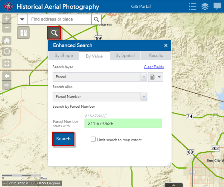
Open the Enhanced Search Widget.
Search for Parcel 211-67-062E
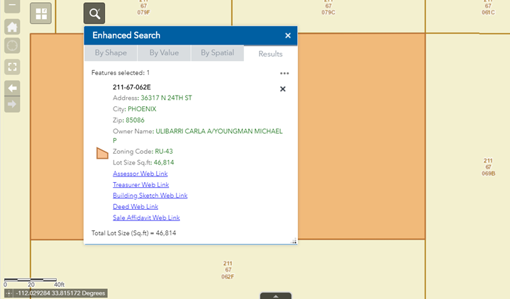
The Map Zooms to Parcel 211-67-062E
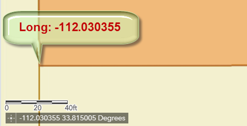
Move your mouse over the lower left corner of the Parcel.
The Longitude Value (X) is -112.030355 Decimal Degrees.
Pay close attention to the graphical scale.
It gives you an idea what a 10ft displacement looks like.
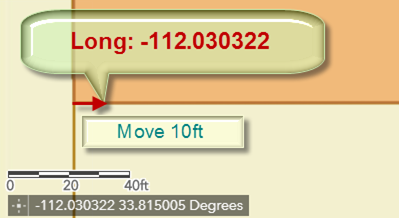
Move your mouse slowly to the right about 10ft tracing the lower edge of the Parcel and examine how the Longitude values change.
The Longitude Value(X) is -112.030322 Decimal Degrees.
For a displacement of approximately 10ft along the X direction, the Longitude Value changed from -112.030355 to -112.030322.
The changes registered in the 5th decimal place.
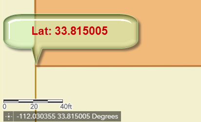
Now examine the change in Latitude.
Place your mouse over the lower left corner of the Parcel.
The Latitude Value (Y) is 33.815005 Decimal Degrees.
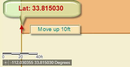
Move up your mouse vertically about 10ft and pay close attention to how the Latitude Values change.
The Latitude Value (Y) is 33.815030 Decimal Degrees.
For a displacement of approximately 10ft along the Y direction, the Latitude Value changed from 33.815005 to 33.815030.
The changes registered in the 5th decimal place.
Now you can see why it is a good idea to report Lat/Long values in Decimal Degrees with 6 decimal places of precision.
This is necessary to maintain accuracy of points on the map.