The Attribute Table Widget allows you to view the attributes of any layer on the map.
You can click on any record and zoom to that feature if the layer has been turned on.
You may also export the attributes as a CSV file and open it in Excel.
Refresh the Web App.
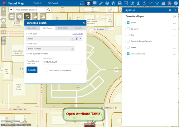
Open the Attribute Table.
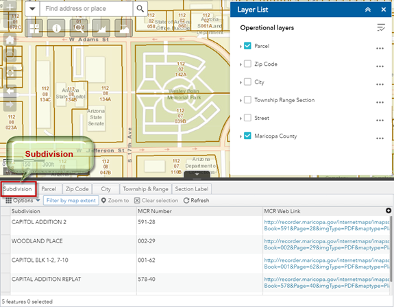
This is how the Attribute Table appears by default.
Within the Subdivision Tab, click on item = Subdivision.
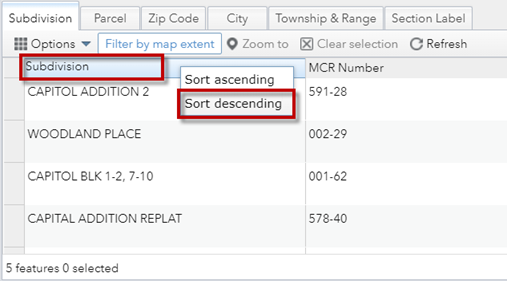
Select Sort descending
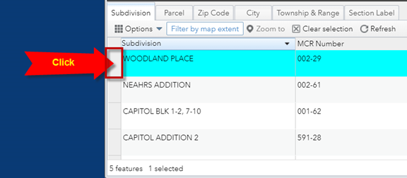
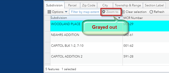
Click on the gray column next to the first record.
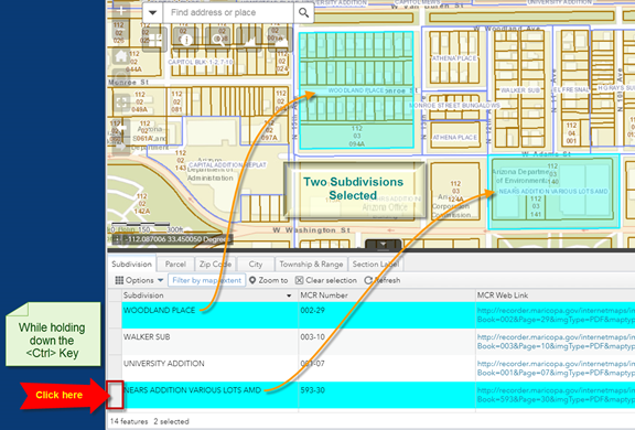
The record gets highlighted in cyan.
Notice, the Zoom To button is grayed out.
Nothing happens when you click on it. Why so?
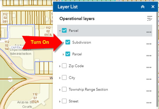
You can zoom to a record only if that layer has been turned on.
Turn on the Subdivision Layer in the Layer List Widget.
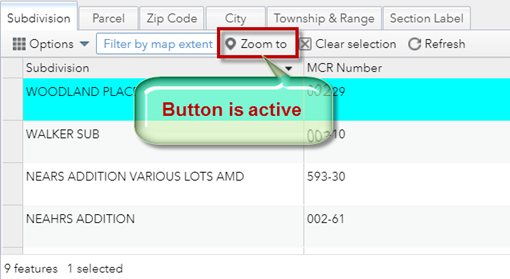
The Zoom To button is now active.
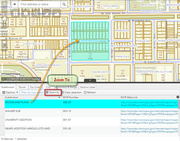
Click on the Zoom To button.
The map zooms to the selected Subdivision.
The selected Subdivision is drawn with a cyan highlight.
You can select multiple Subdivisions by holding down your <Shift> Key or <Ctrl> Key while making a selection.
Hold down your <Ctrl> Key while clicking on the gray column next to another Subdivision.
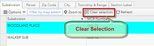
Press Clear Selection to remove the current selection.
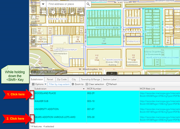
Hold down your <Shift> Key while clicking on any two Subdivisions.
All the Subdivisions in between will become selected.
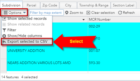
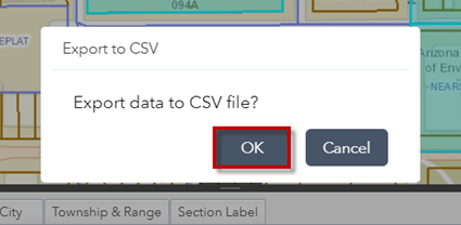
You can download the attributes of these selected Subdivisions as a CSV file and view them in Excel.
Expand Options.
Click on Export selected to CSV
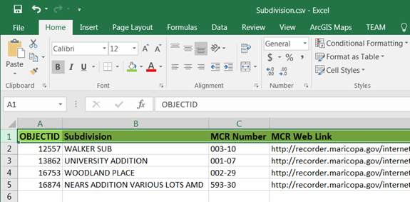
Open Subdivision.csv in Excel
Clear the Selection.
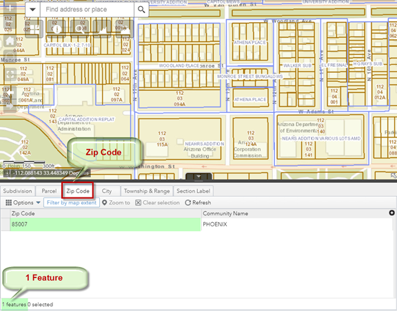
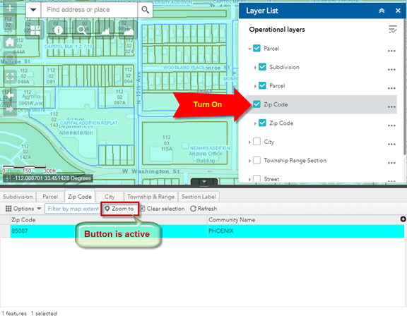
Open the ZIP Code Tab.
The attribute table shows only 1 Zip Code = 85007
This means only one ZIP Code covers the area in your screen.
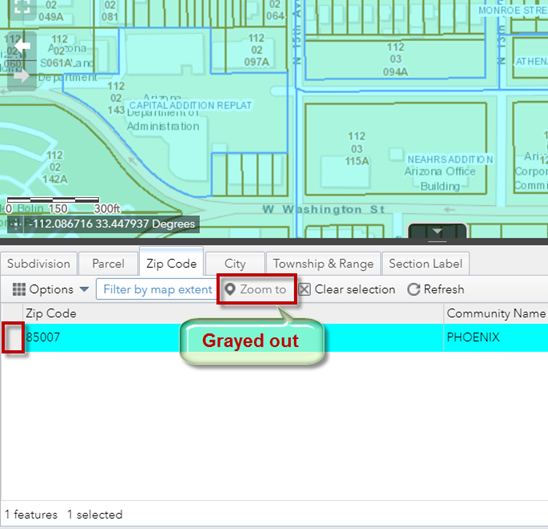
Select this record.
The Zoom To button is grayed out.
You cannot zoom to the selected Zip Code unless you turn on this Layer in the Layer List Widget.
Turn on the Zip Code Layer the Layer List Widget.
The Zoom To button becomes active.
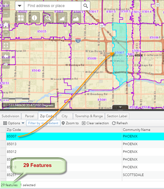
Click on the Zoom To button.
Now you can see the entire ZIP Code 85007 highlighted in cyan.
There are 29 Zip Codes listed in the Attribute Table.
These are the Zip Codes that are visible within your current map extent.
What if you wanted to download a list of all ZIP Codes in Maricopa County?
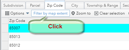
Click on the Filter by map extent button.
This turns off filtering by map extent.
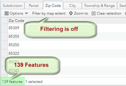
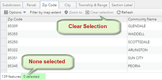
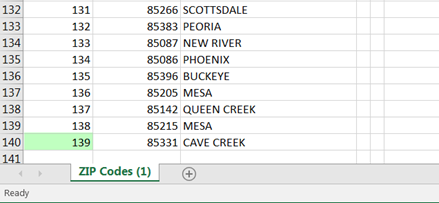
The record count shows 139 features.
There are 139 Zip Codes in Maricopa County.
Currently, you have 1 Zip Code Selected.
If you attempt to download a CSV file, you will get only 1 record.
This is not what you want!
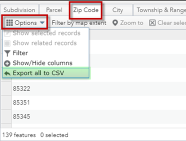
Press the Clear selection button.
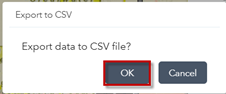
Options | Export all to CSV
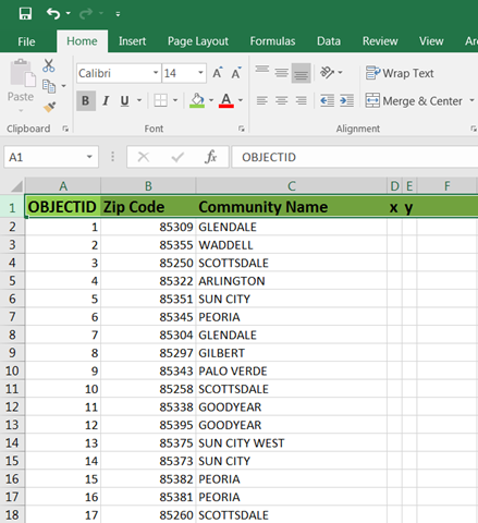
Open in Excel
There are 139 valid ZIP Codes in Maricopa County.
This list can come in handy when validating an address to see if the Zip Code matches a value in this list.
Any value outside this list will be rejected by the Maricopa County Geocoder.
You can view the Attributes of any Layer in the Web App.
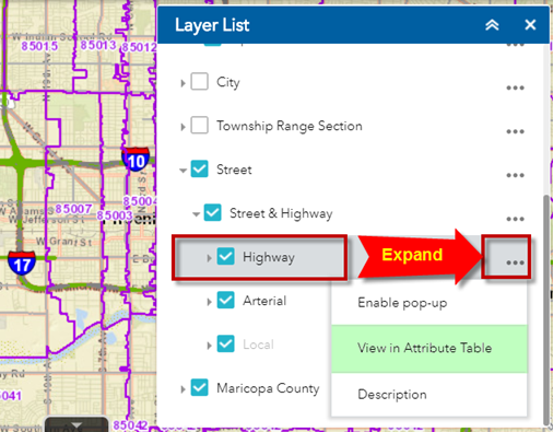
Let’s say you want to view the attributes of all the Highways that are visible in the current map extent.
Expand the Menu for the Highway Layer.
Select View in Attribute Table.
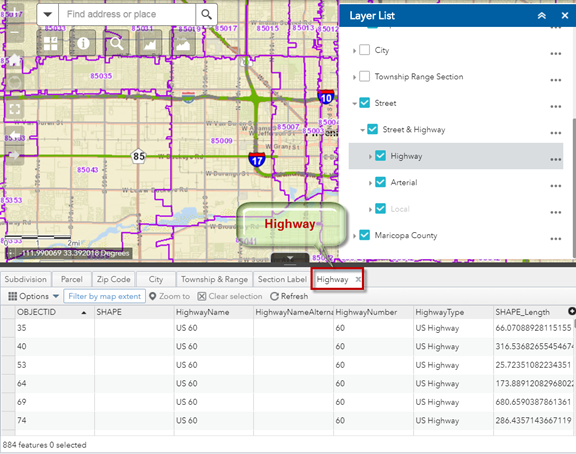
Open the Highway Tab.
You can now explore all the attributes of this data layer.